Conservation
The Scout Loop Trail
Georgetown, Massachusetts · Noah Shupenko
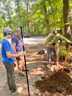
After spending a significant amount of time in the local state forest that ran through my town, I noticed that there was a lack of dedicated signage and directional markings, which made navigation in the state forest more based on memory than maps. As such, I’m mapped out a 2 mile loop where I was able to implement directional markings in the form of painted blazes and a sign with all of the the distance information as well as a satellite overview of the trail. Access was also added to an area of the state forest that floods frequently due to the existence of beaver dams, done by using paving stones to construct an elevated path through the area.
2025 · 64 hoursView project →
Submitted to EagleBase 8/5/2026